Ding Dong, yoohoo!!! Quite some time i didn't update my blog.
So today I'm going to update a little bit about Puchong Hill, which also called as Ayer Hitam Forest Reserve in Puchong.
First of all, this was around 3-4th times i went to hike in Puchong Hill. Why I love to hike in Puchong hill?
Reason 1:Not Easy to be lost
It wont be lost, because Puchong Hill is a circle hill, no matter how you walk, you will get back in the same entrance.
Reason 2:All Day Hike
All day, all time, morning or afternoon, also got hikers around. Because this hill is full of tall trees, thus, it's not hot inside, even sometimes raining also couldnt feel it.
Reason 3:Easy-Moderate level(2hours hike)
It's not a difficult hike, it's suitable for kids till old age people. I don't lie, because all the way you hike, you will see kids, young, teenages, old, tall, short, fat, leng zai, uncles, aunties hiking in this hill.
Reason 4:Puchong Hill is well maintained
There is a club in Puchong just for the purpose to maintain this Ayer Hitam Hill, thus, it's really clean and nice route to walk.
Where is the Puchong Hill located?
WAZE - Type Puchong Ayer Hitam / Taman Wawasan Puchong
Google Map -

In Puchong Hill, there got two route to go with. When you reach Taman Wawasan, you will see a lot hikers over there, everyone start with the same entrance point, thus, if you are the first time hike, you can follow the big gang of people. Or you can ask around the uncles/ aunty, they will teach you the way.
Do not scare of lost, because all the way you hike, you will see hikers in and out. Thus you will definitely won't lost in this hill.
However, i suggest you that reach there by 7am, because if you reach after 7am, no lie, no parking and you need to park 1km away from the entrance point. haha. So you can imagine how many people go there hike.
Ok, let's back to topic.
Today i tried two routes one shot. Because i want to see how far i can did :)
Not dissapointing you guys. I managed to did it!!! And also break my own record, 2 hours hike for two routes.
Trail 1: 7.45am-8.53am (From Car Park -> Peak -> hike down)
 |
| Real Crowded for Sunday Morning. |
 |
| Entrance Point |
 |
| Will go through a bit uphill, but not a problem |
 |
| Continue walk up up up. |
 |
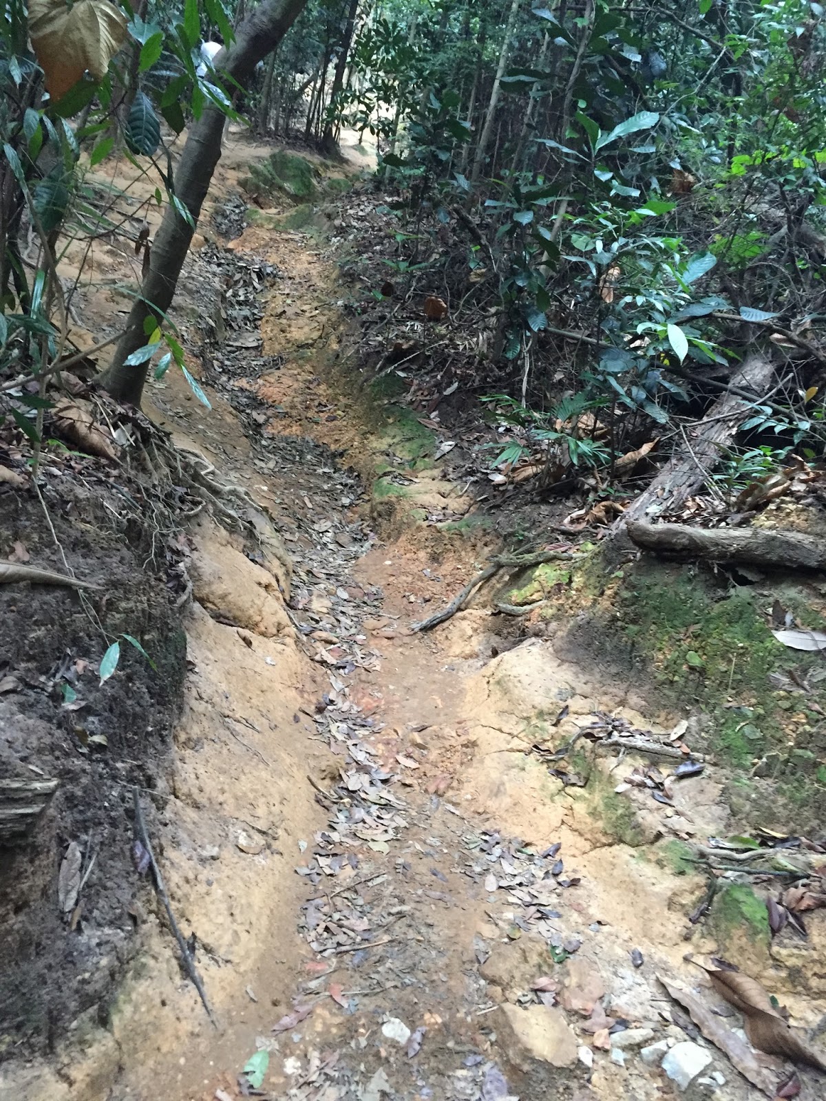
| Will Pass Through a bit of mud rock here. |
Trail 2 to Peak is longer than Trail 1 also difficult than trail 1 as Trail 2 has up down hill, while trail 1 only the last stretch is uphill.
 |
| From here i took the right turn as my trail 1. |
 |
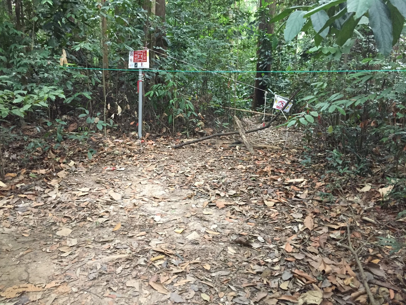
| You will see this sign board, means you are in the correct trail. Just Follow the crowded. |
 |
| As i mention, there is a club of people that maintain this hill, you can see the result all the way when you hiking. |
 |
| It's real clean!!!! |


 |
| A bit of downhill. |

 |
| This is the last stretch, all the way up to peak. |

 |
| Should have around 20 degree uphill, it's just take your own slow pace. |

 |
| When you see this big tree, yeah yeah, you are on the right track. |
 |
| Alomost reach!!! |
 |
| Can you see the bunch of people!!!! That's the peak. |

 |
| ALthough the peak nothing much to see except trees, but all you get is Sweat, Release!!! |
 |
| Hike down by Trail 2. |


 |
| No entry so turn left!! |


 |
| This already fall on the floor!!! |
|
| From here i take the left route as my Trail 2. |
 |
| Keep Walk straight and you will found another split point, turn to right side and start your hike. |


 |
| Peak!!! |
 |
| Hike down using the Trail 1. |


 |
| If got the Blue sky, yoou can have better view on Puchong State. |

 |
| This is the entrance point!! |
Today Thought:
When a human is stress on work, on anything, any problem that cannot solve, come over to sweat, you will find the difference. :)
Do not give up in any circumstances, because if you give up on yourself, no once can help you.
Cheers,
houyan
How to get to the waterfall?
ReplyDeletehello there...will you be organising one hike soon? I would like to join and can i know how long is the maximum hike? I mean the distance..
ReplyDeletehello there...will you be organising one hike soon? I would like to join and can i know how long is the maximum hike? I mean the distance..
ReplyDeleteThere is another trail passing by the temple. The slope is very steep. But if you go slow, shouldn't be a problem.
ReplyDeleteThk u very helpful commentary.
ReplyDeleteVery informative. Thank you.
ReplyDeleteentrance fees?
ReplyDeleteTÜL PERDE MODELLERİ
ReplyDeleteSMS ONAY
VODAFONE MOBİL ÖDEME BOZDURMA
Nft Nasil Alinir
Ankara evden eve nakliyat
trafik sigortası
dedektör
Website kurma
aşk kitapları